I05 cultius 05 cultius 20220905_DTA_AltPenedes_PatxiUriz_SantLloren_d'Hortons_TavernaMamdelBo_DSC1221
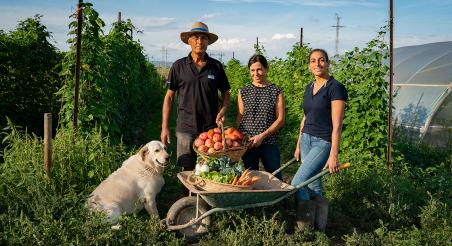
Tomatoes grown in Sant Llorenç d'Hortons, Alt Penedès. PATXI URIZ | BARCELONA PROVINCIAL COUNCIL

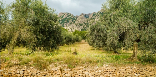
Crops declared in the DUN

Discover which crops are predominant in your area, how they have evolved over time, the type of irrigation used, land ownership, and other relevant aspects of the agricultural sector.


Sources: Map of crops and exploitations of the DUN (2025)

We base this analysis on the map of plots and crops from the Generalitat de Catalunya’s Agricultural Declaration (DUN), aggregating the data at the municipal level. We have extracted detailed information on the area covered by each crop group—including crop type, variety, whether rain-fed or irrigated, and the irrigation method used for irrigated land. We have also examined trends in the declared agricultural area.

The information is presented in a clear and accessible format, categorized by municipality, *comarca* (county), and agricultural area or park. This structure allows for a comprehensive understanding of the crops, their development over time, and other significant aspects of the agricultural sector in the province of Barcelona.
Methodological Note

Data sourceshttps://analisi.transparenciacatalunya.cat/Medi-Rural-Pesca/Mapa-de-cultius-de-Catalonia-amb-origen-DUN/yh94-j2n9/about_data:

The data is updated annually.

It is important to note that this includes all declared agricultural crops (herbaceous crops, fruit trees, vineyards, olive groves, vegetable crops, citrus, nuts, fallow land, etc.) as well as eligible pastures declared in the Single Agricultural Declaration (DUN). For the "Pastures" category, the figure recorded represents the eligible area—in hectares (ha)—of the SIGPAC parcel declared in the DUN. This area already accounts for the pasture eligibility coefficient (CAP) and meets the requirements established for receiving CAP (Common Agricultural Policy) subsidies. "Ineligible" areas (such as forestry, unproductive land, grazable by-products, and buildings or structures) are excluded.

When only a single municipality is selected—either on the map or via the filters—the map automatically switches to a viewer that displays details for all declared plots within that municipality, overlaid on an orthophoto.

Creation date
Last Updated
More data from
Share
Related Initiatives

Barcelona Challenge for Good Food and the Climate

Based on the C40 Cities Declaration for Good Food and the Milan Urban Food Policy Pact, the Barcelona Challenge for Good Food and Climate is a call for cities and their inhabitants to engage in a series of commitments related to

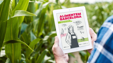
Guia pel disseny d’estratègies alimentàries

'Alimentem Barcelona' és una eina destinada als Ajuntaments i altres entitats locals que tinguin interès a impulsar un canvi en la política alimentària del seu municipi o àmbit d'acció.

You might be interested