Summer forest fires are not put out only in summer: it is necessary to work all year round. Firefighters, engineers, informants, lookouts, rural agents, volunteers and, above all, prevention experts, are very aware that the measures taken during the winter months are crucial to stop tomorrow's fires and they wonder if the actions traditionally carried out They are sufficient in the face of the threat posed by large forest fires. As global warming increases the vulnerability of Mediterranean forests, what solutions need to be implemented to ensure good preservation of the landscape?
The sixth BCN Smart Rural Data Bite, entitled “Fireproofed”, starts from this question and stops to analyze the state of the agroforestry mosaic in the Barcelona district. Next, it evaluates the real extent of forest fires in the territory and shares data from the Barcelona regions with more herds grazing in the forests to try to find out if they suffer fewer fires. Finally, it studies the forest area managed on the ground in the last 10 years.
According to this study, the mosaic of crops, pastures and forests was the predominant landscape in the Barcelona district in the fifties of the last century, but this balance has been lost: currently, only 78 of the 311 municipalities in the district enjoy a mosaic landscape, which represents 25% of the total. On the other hand, between 1956 and 2018, the number of municipalities with a forest landscape increased from 104 to 193, which represents an increase of 84% in sixty-two years. Today, nine of the twelve regions of Barcelona have a forest landscape and they are Berguedà, Moianès, Osona, Bages, Baix Llobregat, Garraf, Maresme, Vallès Occidental and Vallès Oriental. Of the remaining three, Alt Penedès and Anoia still preserve a mosaic landscape, while Barcelonès shows an urbanized landscape.
Apart from these highlighted data, other interesting results that emerge from the new analysis report prepared by the BCN Smart Rural team are the following:
- 45% of the municipalities in the Barcelona province changed their mosaic index between 1956 and 2018, and, of these, more than half have gone from a mosaic landscape to a forest one. The retreat of the agroforestry mosaic in favour of a homogenized landscape based on continuous tree masses is widespread.
- If we stop to specifically analyze the municipalities that enjoyed an agricultural landscape in 1956 and now have a forest landscape, we find a list headed by six municipalities from the same region: Maresme. They are, specifically, Canet de Mar, Montgat, Arenys de Mar, Sant Pol de Mar, Teià and Mataró. Badalona also stands out, a city in Barcelona that has suffered a significant loss of its agricultural heritage.
- Between 2001 and 2021, the county most affected by fires is Bages: with 5,442 hectares burned, it represents 33% of the total. They are followed by Anoia, with 3,565, and Vallès Occidental, with 2,708. The region that has suffered the least from the extent of the flames is Vallès Oriental: in the last twenty years, only 53 hectares have burned. They are followed by Osona, Barcelonès and Maresme.
- The municipalities with the largest burned area have a forest landscape: of the 16,494 hectares burned in twenty years, 12,329 are located in the middle of a forest landscape. In the towns that enjoy a mosaic landscape, only 3,289 hectares have burned. And in the municipalities with agricultural landscapes, 732 hectares.
"The municipalities least affected by the flames are those with a more agricultural landscape"
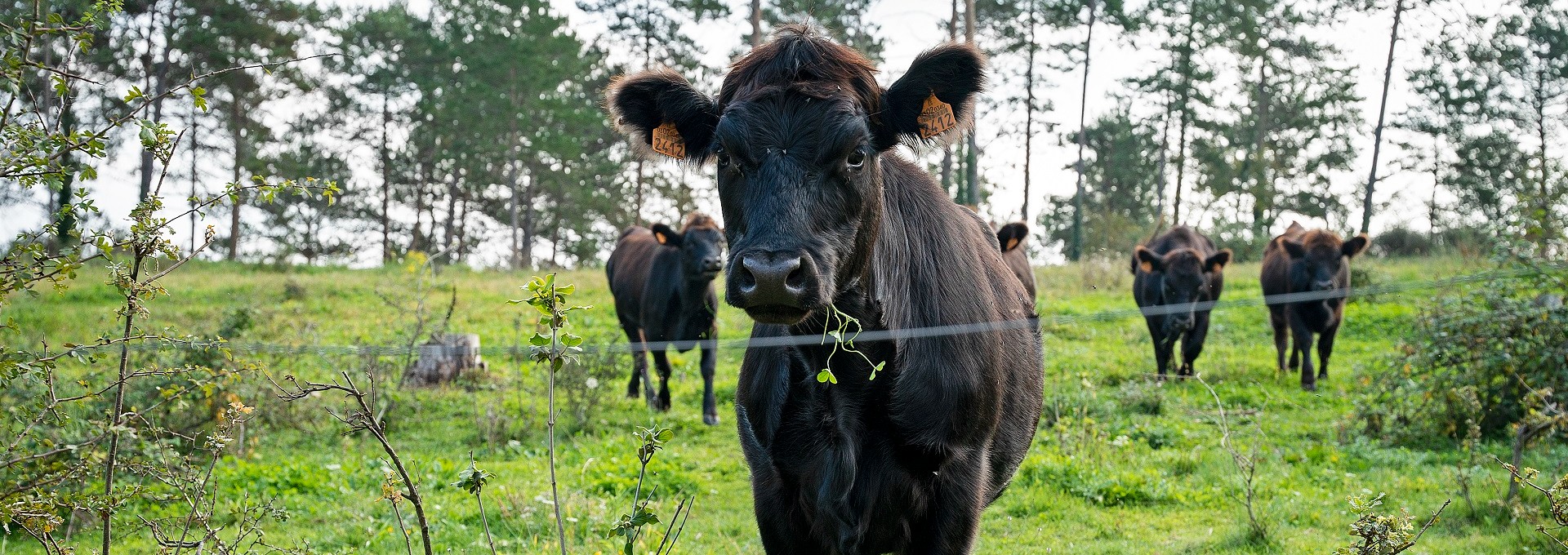
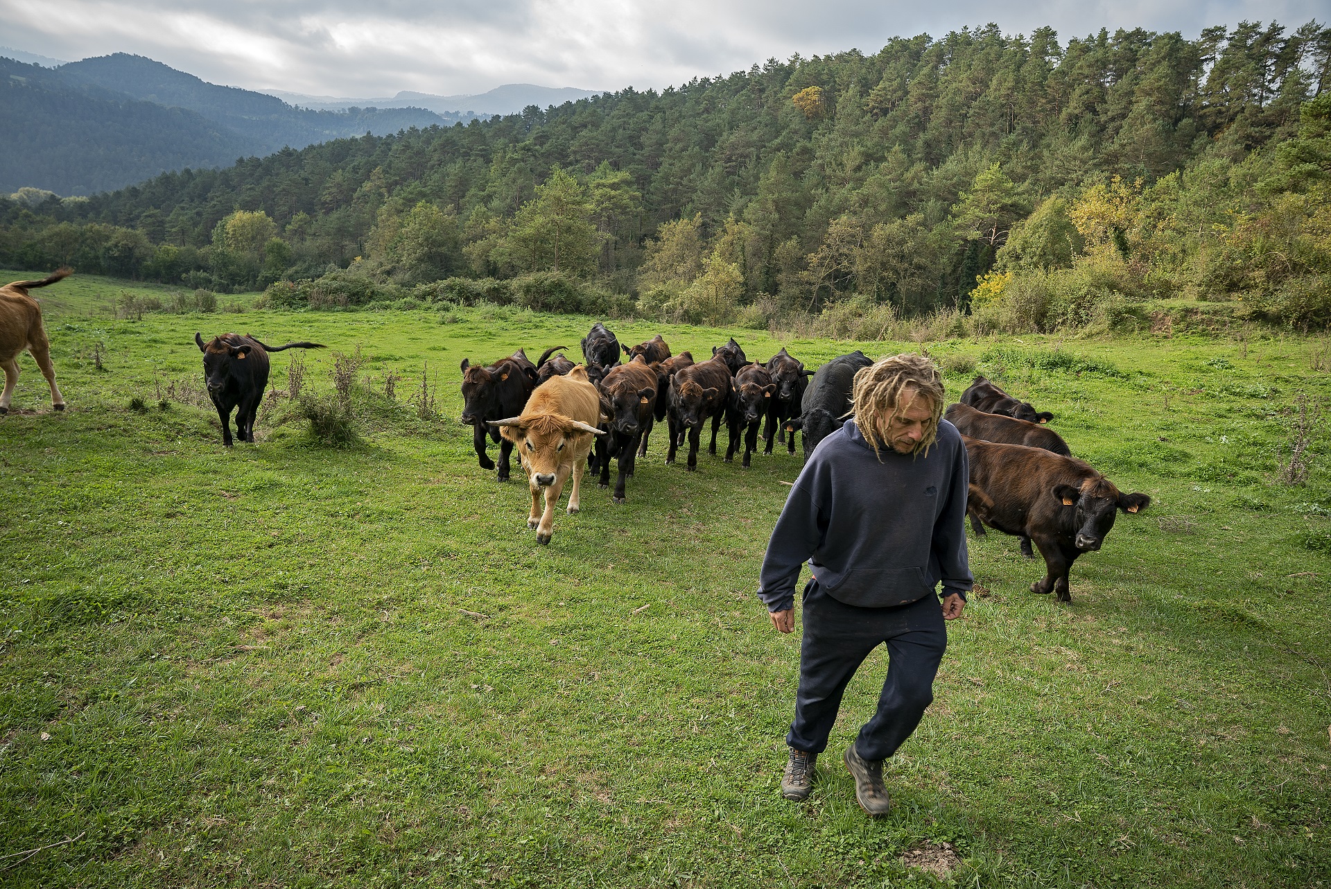
- Currently, the Barcelona province is very close to having enough animals grazing extensively to reduce the amount of vegetation with potential fuel that accumulates in the forests and their longer-lasting conservation. That said, the presence of herds throughout the territory should be encouraged, since 78% of extensive farms are concentrated in two of the twelve counties of Barcelona. They are Osona and Berguedà, two of the regions that have suffered the least from the extent of the flames in the last twenty years.
- The forest area in the Barcelona province is 514,000 hectares. Of these, 95% are privately owned, a percentage that far exceeds that of the whole of Catalonia, which is 76%.
"95% of the forests in the Barcelona district are privately owned"
- In the Barcelona province, 44% of the forest area is included in management plans; specifically, 231,851 hectares. This percentage drops to 32% in Catalonia as a whole, where 1,416,831 hectares are not planned by any forest management instrument.
- In Barcelona counties, the area managed on the ground is much lower than the area included in management plans: between 2011 and 2020, action has been taken in 35% of the territory's forests. Specifically, work has been carried out on 137,676 hectares. That said, the percentage exceeds that of all of Catalonia, which is 28%.
- Currently, the Barcelona Provincial Council prioritizes forest management in the areas defined as Priority Management Areas (AGP). These were born with the essential objective of guaranteeing in the short and medium term that all forests located in areas of high fire risk are managed and prepared to face large fires. In addition, extensive livestock farming is also promoted through grazing agreements between the owners and local shepherds and livestock farmers.
- Forest management data in the Barcelona district show that, annually, an average of nearly 14,000 hectares are managed. 2013 is the year in which the least forests were managed: 10,604 hectares. This figure doubled in 2020, the year in which the most forest area was managed in the territory.
- Between 2011 and 2020, the Barcelona Provincial Council managed nearly 14,500 hectares through the Forest Owners' Associations. By county, the corporation has carried out more work in Bages, with 4,406 hectares managed. This prioritization takes into account that the territory has suffered significant forest fires in the past: as we have pointed out before, Bages is the Barcelona region where the most forest area has burned in the last twenty years.
The origin of the data
To prepare this analysis report, we began by studying how the landscape of the Barcelona district has changed in the last sixty years. With this objective, the data experts responsible for the study have based themselves on the cover maps of 1956 and 2018. From here, they have related the agricultural area with the forest area of each municipality and, to facilitate the understanding of the results, have created a new indicator that they have called the “Mosaic Index”. This marker allowed them to determine the predominant type of landscape in each municipality of the Barcelona province and was very useful when assessing the current state of health of the agroforestry mosaic and its evolution over the years. It has also helped them understand what type of landscape suffers the most from forest fires: agricultural, forestry or agroforestry mosaic.
To analyze the real extent of forest fires in the Barcelona district, the forest fire mapping bases of the Generalitat of Catalonia for the years 2001-2018 have been used and have been completed with data from the Fire Information and Surveillance Plan. forestry of the Barcelona Provincial Council for the years 2019-2021.
The pasture area figures are those recorded in the Geographic Information System for Agricultural Plots (SIGPAC), while the capacity of the territory's pastures to feed extensive herds has been analyzed based on data provided by the Department of Action Climate, Food and Rural Agenda related to the Registration of livestock farms and the methodology provided by the Technological and Forestry Center of Catalonia.
To study the management that has been carried out in Catalan forests during the last ten years, data from the Forest Observatory of Catalonia has been used, which collects figures provided by the Forest Property Center (CPF) and the Department of Climate Action, Food and Rural Agenda of the Generalitat of Catalonia. These data were detailed by region, with a section dedicated to the regions of all of Catalonia and another for those that belong to the Barcelona province. Information on forest ownership has also been incorporated, in addition to specifying whether or not the forest area is included in a management plan.
The analysis report ends with figures referring to forest management carried out by the Barcelona Provincial Council through the Technical Office for Municipal Forest Fire Prevention and Agrarian Development.
The need to promote extensive livestock farming
The study of the data referring to the relationship between the mosaic landscape and the incidence of forest fires allows us to see the importance of forest management and the promotion of extensive livestock farming, whether within the forest or in areas of grass. The figures speak for themselves: the two regions in which these two actions are added show the most favourable forest fire data. These are Osona and Berguedà.
Unfortunately, in this data bite, we have been able to verify the progressive loss of agroforestry mosaic, the reality of very extensive and poorly managed forests, and the presence of extensive herds that are concentrated above all in a very specific area of the territory: apart from Osona and Berguedà, the rest of the counties do not have enough cows, sheep and goats to guarantee the preservation of their landscape.
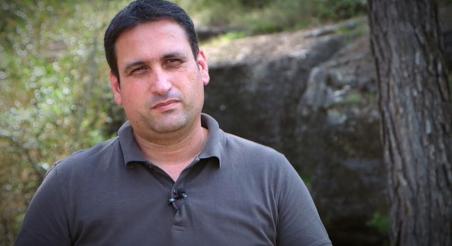
As stated by Sònia Callau, head of the Territorial Agrarian Directorate of the Barcelona Provincial Council, "the delimitation of the forest areas where management must be prioritized (the so-called AGP), the establishment of agreements with the owners to promote that private forests are well managed and the promotion of extensive livestock farming in these areas of special risk, through agreements with forest owners and shepherds and livestock farmers, are measures that can improve the capacity of our forests to face the threat posed by large forest fires. That said, there is still a lot of work ahead, as the data demonstrates. It is key that forest owners, the extensive livestock sector and the administrations work together to face this great challenge that lies ahead.
In this sense, it is also important to highlight the role that forests and agricultural spaces play in the sequestration of atmospheric carbon, as well as the impact that forest fires play on the generation of greenhouse gas emissions. If we add all these factors, we can better understand the importance of regenerating the agroforestry mosaic of the territory and the determined commitment of the Barcelona Provincial Council to improve the balance of forests, pastures and crop fields.
For more information about this data, please contact Lucía Nieto and Daniel Farré, territorial engineers and GIS experts of the BCN Smart Rural strategy.
— BCN Smart Rural Editorial —