Investigate
Explore the indicators revealing the impact of our food choices and how they shape the agrarian landscape of the province of Barcelona.
Every data point tells a unique story. Discover it!
Investiga
Dades:
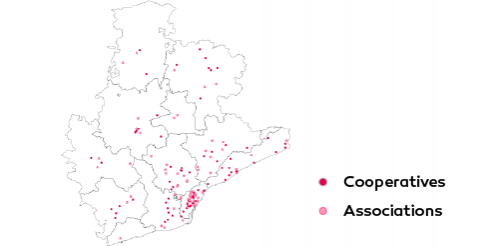
Agricultural cooperatives and associations
Does Barcelona's province have enough agri-food cooperatives and associations to supply local products to citizens? Discover the amount and type of initiatives aimed at serving the farmers of the region.
Source: Own research based on multiple data (2022)
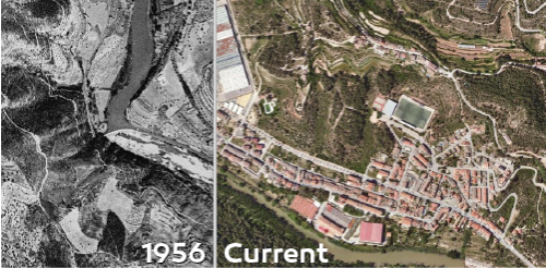
Viewer of historical orthophotos
The visualization of orthophotos captured at the province in Barcelona allows to identify the areas where there are forests, pastures and crops, and to study their evolution in various periods.
Source: Original creation based on ICGC orthophotos (1945-2024)
Health Facilities
To ensure the physical and mental well-being of those working in the agri-food sector in the province of Barcelona, we are providing a map showing the locations of Primary Care Centers, hospitals, and pharmacies in all municipalities.
Source: Public facilities by the Government of Catalonia (2024)
Cultural Facilities
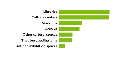
To inspire creativity and enrich the lives of those working in the agri-food sector in Barcelona's province, we share a map highlighting theaters, libraries, museums, and other cultural spaces available in all municipalities.
Source: Public facilities by the Government of Catalonia (2024)


